By Mauro Protomastro | 2020-06-19
Order by: Trending (past 30 days)Date
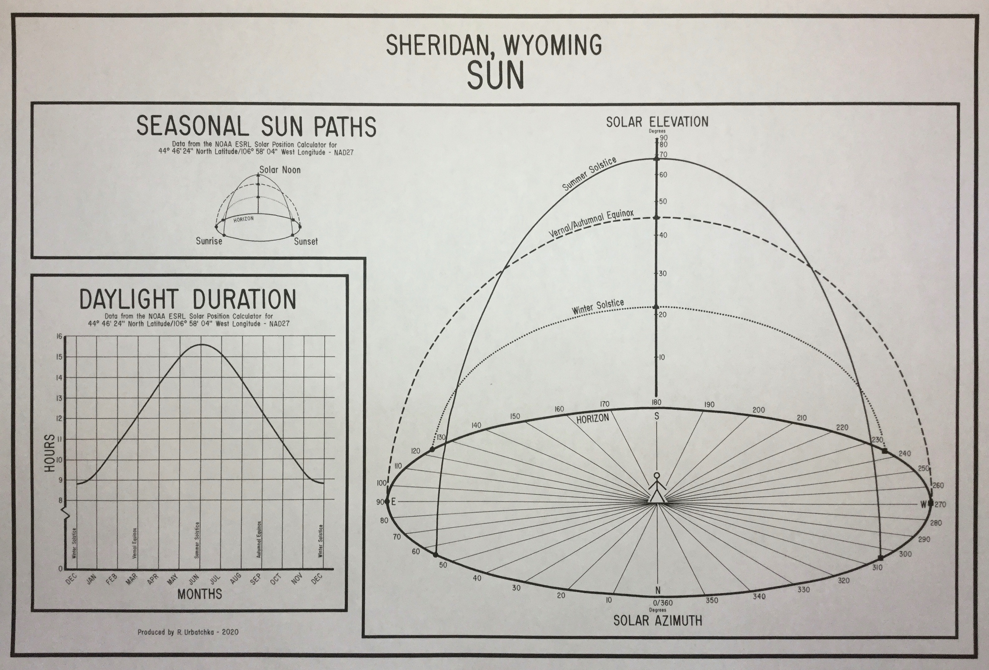
On 06/20/2020 by Rich Urbatchka | Sheridan, Wyoming
This spring I have researched, designed, and hand drawn nine of these charts for friends and family. They cover different latitudes from Wasilla, Alaska to Scottsdale, Arizona. My educational background is a geography degree (with emphasis in cartographic design) and a math degree (in secondary education). I have produced a series of weather charts for my hometown of Sheridan, Wyoming and felt few people really knew much about the sun’s pathway for their latitude. I immediately decided a three dimensional approach was needed. After researching and designing in pencil on paper, all charts are drawn “old school” by hand with technical pens on vellum. This one is approximately 12” x 18” . All charts used four different ellipses at varying sizes and degrees which were also graphically calculated and hand drawn.
Forty-five year old Koh-I-noon Rapidometric pens & Albanene vellum.
Research - 2 hours
Design - 5 hours
Inking - 6 hours.